Tips for configuring multi UAV Solutions for ISR operations.
Low altitude UAVs (Drones) with high-powered remote sensing capabilities have opened up a wide range of additional deployment options. Which were not previously available to ISR operations.
ISR operations do vary markedly in their requirements. From a simple React to an incident to Complex Mission SA (Situational Awareness), or Persistent Surveillance.
Drones are generally not bought on their own. But as part of overall operational solution requirements. These solutions have to calibrated, or geared, according the level of need and integrated into its respective ISR, or monitoring, operations.
Different levels of requirements
Airborne Drones recognises this challenge and has developed an array of ISR solution options that addresses different levels of requirements from:
- simple to complex,
- medium to long range, and
- ad-hoc incident response to persistent aerial presence.
The following solution configurations are found to be most prevalent:

Multi UAV Solution configurations
React: Rapid Response – Simple Mission
This configuration provides a highly mobile short-range solution that can respond immediately and rapidly to a simple incident in any direction with no changes to setup.
Respond: Incident Response – Complex missions
This configuration enables a comprehensive response to a complex incident. While also managing multiple variables and integrating various stakeholders providing situational awareness for an ongoing mission over a wide area. This is a lightweight solution that provides a broad span of control.
ISR: Incident Response – Complex mission/ Persistent surveillance <20km
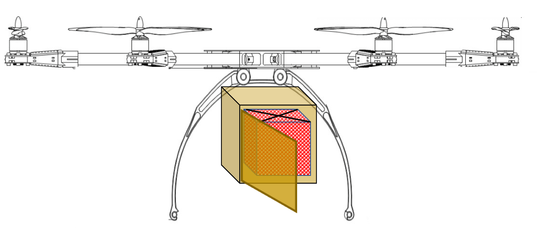
This configuration enables situational awareness over a wide (<20km) area while managing multiple variables and integrating various stakeholders with a persistent flight mission objective at detailed level. This configuration includes a SAR sensor which is able to detect signs of intruder presence in the surrounding area and produce a detailed 3D digital representation of targets and target area.
ISR 20+: Incident Response – Complex mission/ Persistent surveillance>20km
This configuration enables situational awareness over an extended (>20km) area. This can also manage multiple variables and integrating various stakeholders with a persistent flight mission objective at detailed level. This configuration includes a SAR sensor which is able to detect signs of intruder presence in the surrounding area and produce a detailed 3D digital representation of targets and target area.
ISR Extend: Long range response & surveillance
This configuration enables situational awareness and the ability to manage multiple variables and integrate various stakeholders with extensive, long range and persistent ISR flight mission objectives shared across over multiple UAVs at a very detailed level. This configuration includes a SAR sensor which is able to detect signs of intruder presence in the surrounding area and produce a detailed 3D digital representation of targets and target area. With the electrical motors this also a low maintenance solution.
ATLAS Discover: Extra long-range exploratory surveillance
This configuration enables extra-long, focused reconnaissance and surveillance missions providing situational awareness for multiple stakeholders. This configuration includes a SAR sensor which is able to detect signs of intruder presence in the surrounding area and produce a detailed 3D digital representation of targets and target area.
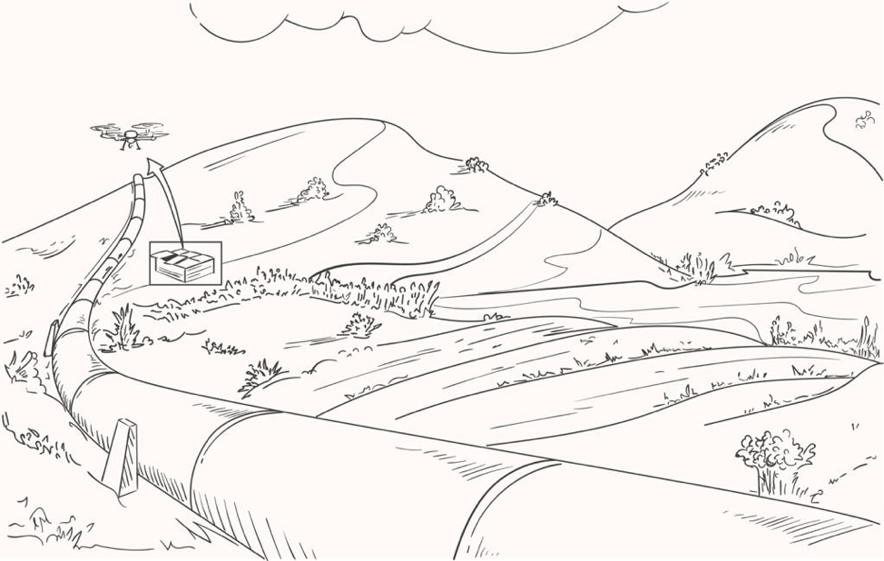
Pipeline: Long range pipeline monitoring & management
This is a long-range line inspection & monitoring solution. It can perform automatic gas leak detection, right of way monitoring, route proving and provide digital twins. As well as security surveillance.
TIPS for configuring multi UAV solutions for long-pipeline inspections and monitoring.
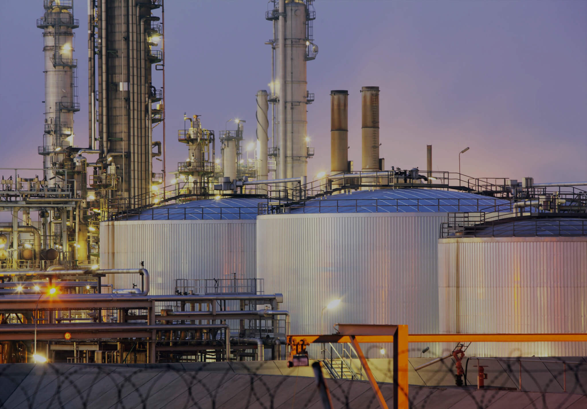
Long line infrastructure installations face difficult challenges. Long line infrastructure could include: railway lines, oil and gas pipelines, water pipelines telecommunications infrastructure, power lines and roads.
These long line installations are generally measured in hundreds, if not thousands, of kilometres. Frequently in remote areas in harsh conditions, and with limited, or no infrastructure.
Each of these installations have different operational pressures and priorities.
Railway lines with high speed trains have a short window within which to conduct route proving before the next high-speed train trip.
At the same time, Oil and gas pipelines have a short period in which to respond the a leak in order to limit damage, financially or to the environment. Long interruptions to power and water supplies can have an adverse effect on the communities they serve.
Long range drones are deployed with great success in these situations where the long range nature of these operations require different deployment methods depending on operations requirements.
To take advantage of the sensor power that low altitude UAVs are able to provide, one has to take into account that the performance of these UAVs. Typically they achieve flight speeds of 60-80km/h.
To be able to cover an extra-long range installation of up to a 1000kms or more in a very limited window of time. This will require establishing Remote UAV Surveillance Stations every few 100kms using VTOLs with a 3-hour endurance capability. Depending on how much time may be required to deal with an event at a Point of Interest (POI).
Multi-rotors generally fly for less than one hour. However, VTOL fixed wings in the sUAV range often reach flight times of 2 to 3 hours. UAV deployment configurations will depend on business drivers such time-criticality and/or cost-efficiency.
Bi-directional surveillance stations for multi UAV solutions.
Limited monitoring window, Business Continuity, Redundancy
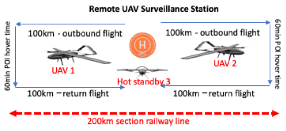
Option A. 60-minute hover time
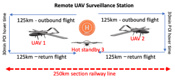
Option B. 30-minute hover time
Option C. 0 minute hover time

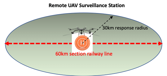
Option D. 30 km response radius
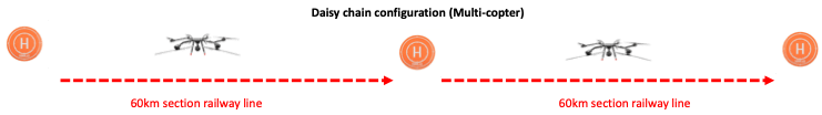
Daisy chain multi UAV solutions.
Less time-critical, cost-efficiency more important,
Option E. Daisy chain – VTOL

Option F. Daisy chain – Multi-copter
Option G. Daisy chain – VTOL Petrol