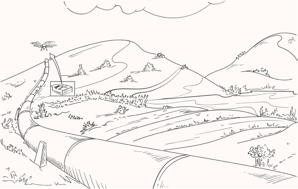
Using drones with remote sensing technologies for forest management
Forest Fires
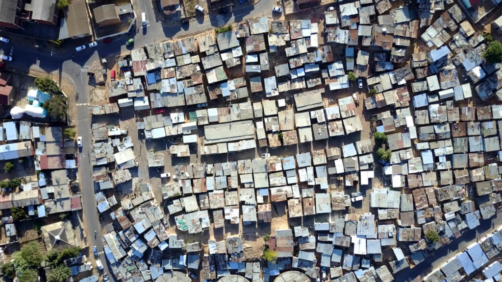
Very destructive forest fires that started on 18 April 2021 on the slopes of Table Mountain in Cape Town South Africa. It destroyed a number of historical buildings and inevitable brought attention back to responsible forest management practices.
In this case there are 2 main contributing factors:
- climate change
- data from the South African Weather Service Cape Point monitoring station show clearly that average temperatures have been rising steadily over the past six decades.
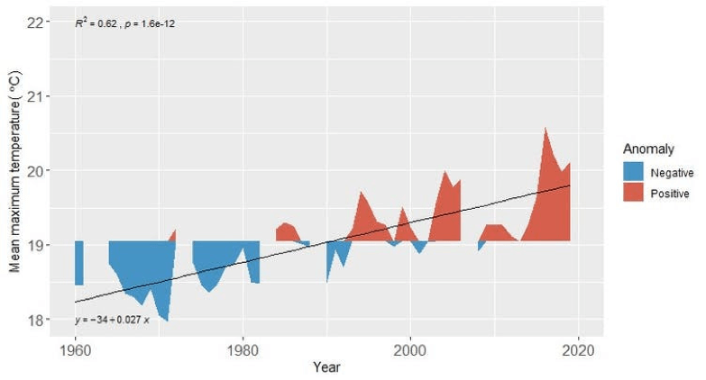
- The steady increase in hot, dry weather will dry out the vegetation. Making it more likely to catch fire, and for fire to spread. This phenomenon is not restricted to the Cape. It is widely reported in other parts of the world.
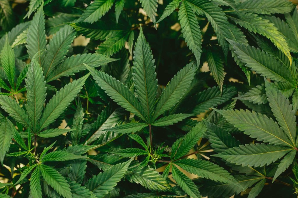
- Alien trees
- The introduction of alien trees, which increase the fuel available to burn. And that burn is with a much higher intensity than the natural fynbos.
The ability to closely monitor the bio mass of alien vegetation is a key element in forest fire prevention.
Forest Management Applications
How remote sensing technologies make a difference
Remote sensing technologies can enhance forest managers’ ability to manage forestry operations in an increasingly complex and challenging environment
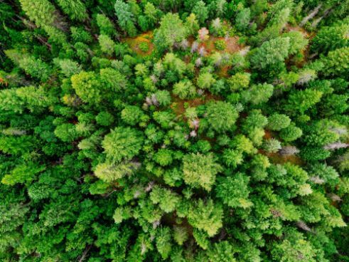
Forest health
Often Forest health assessments conducted using broad scale aerial reconnaissance. This is then followed by ground truthing exercises. With which to verify the results. But this is limited. Because it is qualitative, subjective and dependent on the skill of the surveyor

Forest structure
Assessing the structural attributes of even-aged forest plantations is only possible using small-footprint discrete return lidar data.
Forest productivity
A key objective is to predict the leaf area index (LAI) is a key input variable into process based models to rapidly assess forest productivity.
Forest species composition
Multispectral satellite image data are used to carry out genus level classifications in forestry. But with airborne hyperspectral image data to discriminate not only even aged tree species, and between different species, but also differentiate among the age classes of the same species.
Forest change detection
While medium resolution image data can accurately identify clear-felled stands. High resolution image data captured by remote sensors on an airborne platform, can identify replanted compartments, and the weed status of those compartments.
Micro earth observation satellite bands and applications
Wavelength Range Intended Application
440-510 nm (blue) Water bodies, soil/vegetation, deciduous/coniferous.
520-540 nm (xanthophyll) Silt in water and deforested lands, urban areas
520-590 nm (green) Green reflectance peak for plant vigour
620-680 nm (red) Chlorophyll absorption, roads, bare soil
690-730 nm (red-edge) Plant stress
840-890 nm (near-infrared) Plant-biomass estimates, water bodies, vegetation
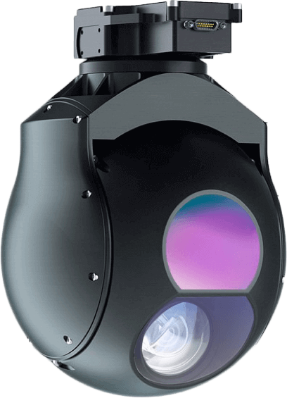
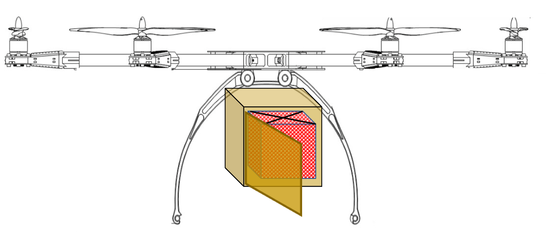
Surveying forest stands and single trees using drones
Using different sensors on airborne platforms tree heights, crown radii and crown base heights are very accurately derived.
This expands the use of UAVs for forest applications. This includes forest inventory, forest growth, forest health, forest production, wildlife ecology and forest protection.
The following data are collected by UAVs with a very high spatial resolution (between one and a few centimetres).
- Multispectral- and hyperspectral cameras register different wavelengths. This can indicate tree condition by characteristics of the tree crown reflection.
- Cameras, which operate in the visible spectrum, can perform detailed assessments of forest structure or single tree properties.
- A laser-sensor on a UAV provides very high point densities. Therefore generating a detailed image of the stand and crown structure as well as the ground surface structure.
- Thermal imaging cameras register the different thermal reflections and can probably be useful for ecological topics.
The sensors for positioning and orientation of the platform during data capture influences the quality of analysis options.
The more precise the data, the better the subsequent analysis. As a high point density is an important factor for successfully deriving single tree attributes. Only UAV based surveying can achieve this.
UAV LiDAR making a difference in forestry management
The benefits of UAV LiDAR in forest management are wide and varied.
The ability to simultaneously visualize the ground and model the canopy structure provides significant advantages to the forestry industry. Traditionally, foresters and land managers have relied on topographic maps for terrain classification. As well as time consuming field-based surveys to obtain tree volumes and height information. LiDAR data provides significant improvements over both these techniques.
Application Specific benefits of UAV LiDAR for Forest Management
Forest management
LiDAR data is hugely effective in understanding the forest canopy and terrain. This assists with assessing forest health, calculating forest biomass, classifying terrain and identifying drainage patterns.
Vegetation mapping within forests
LiDAR data can measure the three-dimensional characteristics of plant canopies. They can then estimate the vertical structure of vegetation communities.
Woodland valuation
It is possible to assess the volume and growth rate of trees to calculate the value of the forest with LIDAR data.
Unlike other aerial surveys such as photography, LiDAR can ‘see through’ woodland and produce 3D models of the forest:
- Canopy
- Undergrowth
- Forest Floor
Case study:
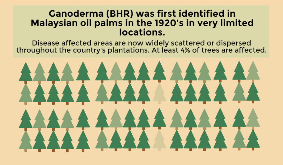
Forest management with drones in controlling palm oil deforestation of rain forests of Indonesia and Malaysia

Decreasing deforestation challenge countries around the world. As well as increasing agricultural productivity on existing farmland to prevent forest clearing for cropland expansion.
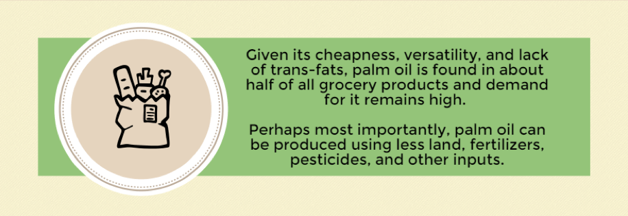
The world bank estimates that to meet vegetable oil demand in 2020, would require 6.3 Million hectares of oil plantation. And using soybean oil instead would require an additional 42 Million hectares. An area roughly the size of California.
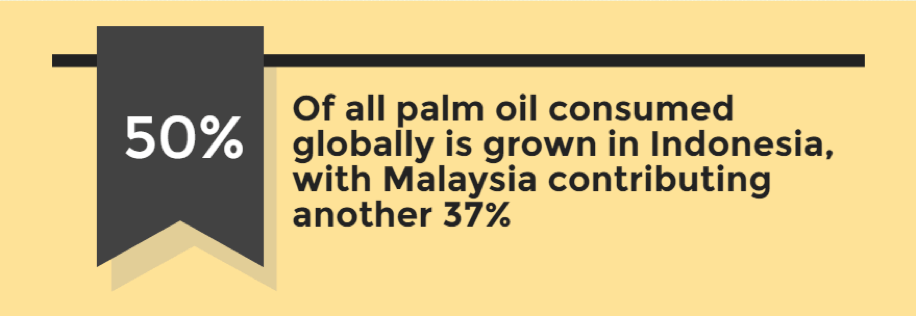
Forest loss in Indonesia
Growth in palm oil plantations are contributing to a large portion of Indonesia’s forest loss in the last two decades .

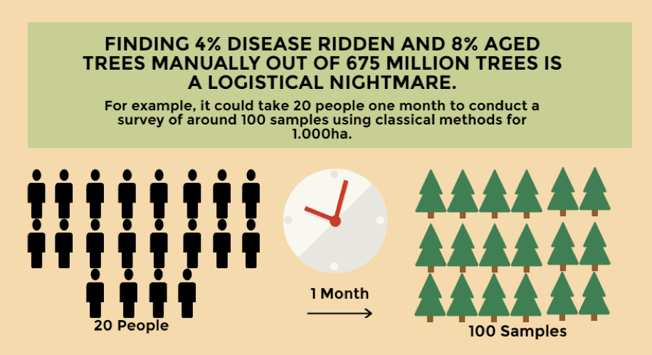
Oil palm farming is very labour intensive. This is because they provide more jobs per hectare than any other farming. This is all year round rather than seasonal.
Palm trees achieve yields at the age of 9-18 after which they gradually decline.
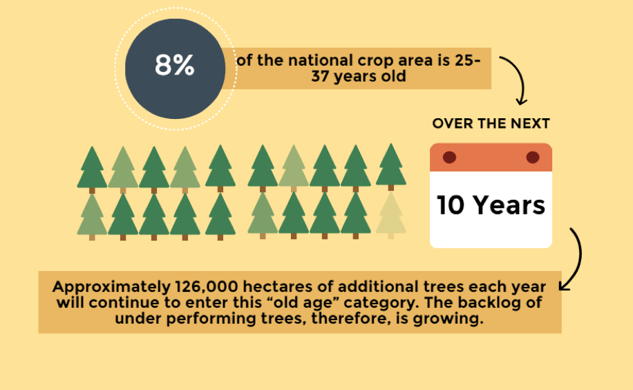
Due to labour shortages there is a growing backlog of underperforming trees. The increase in palm oil prices have climbed over recent years. However, growers are resisting the option of replacing the old and producing trees in a time of record profits.
The government committed over US$135 million to jump-start a national oil palm replanting program targeting smallholder producers:
- replacement rate of 100,000 hectares per annum by providing grants to smallholders covering the cost of replanting.
- commercial palm oil companies will also replant upwards of 100,000 hectares per annum. This will result in a net 200,000 hectare per annum total replanting scheme.
But there is a labour shortage.
- Most trees are hand-harvested, fertilized, pruned individually. And otherwise cared for by a largely immigrant labour force.
- Fruit bunches left unharvested, rot on the trees.
- The labour pool is roughly 491,000 workers, of which 76 percent were from Indonesia.
UAVs are now a critical element in solutions to the Oil Palm/Deforestation problem.
Using sensors on an airborne platform include multispectral, infrared and thermal sensors. This offers the possibility to research such aspects as plant health. Additionally, it offers possibilities for highly targeted responses. Including to disease and growth variations, and the capturing and geo-tagging of high resolution images.