Wildlife & Game Monitoring
How our drones help
Wildlife control is the method by which the position and health of wildlife and game is monitored. Methods typically vary depending on the size of the area and the number of wild animals, but all methods should be capable of obtaining information regarding the position and condition of the game.
PROTECTION AGAINST POACHING

WILDLIFE HEALTH MONITORING

LOW NOISE IMPACT DOESN’T DISRUPT ANIMALS

Livestock monitoring
One of the most efficient ways in which to monitor livestock is via wildlife drones. These small unmanned aerial systems (sUASs), also known as unmanned aerial vehicles (UAVs), have a number of advantages for gamekeepers:
Drone monitoring allows for surveillance of larger areas, even during the night, and enables quick and efficient monitoring of wildlife.
GPS location and visual information to aid in wildlife inspection.
Low noise footprint which does not scare the animals.
Conservation drones can be equipped with different types of cameras and sensors, including thermal, providing complete and accurate information.
UAVs can gather footage and compare the results over time, allowing trends and patterns to be identified.
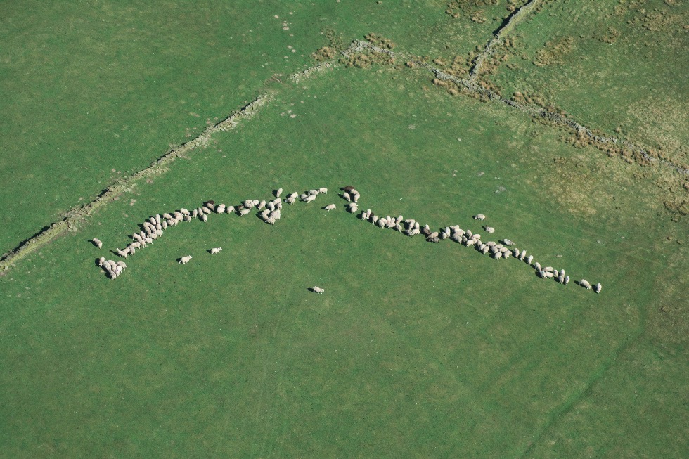
Drones are becoming a popular choice for conservation purposes as they enable gamekeepers to watch out for poachers, keep tabs on the wildlife with its population size, and protect the landscape. In fact, a UAV wildlife survey is often much more effective than those carried out on the ground by conservationists.
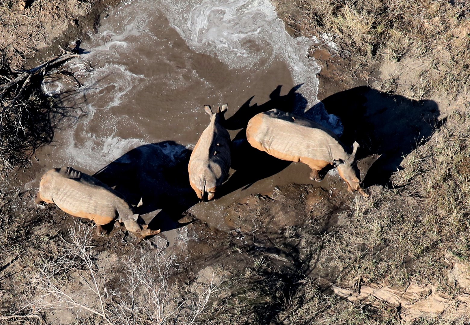
Rhino poaching numbers have escalated in recent years as the demand for rhino horn in China and Vietnam continues, and various methods have been trialled in a bid to combat poaching. Hidden cameras, GPS tracking, satellite imagery, predictive analysis, and hidden cameras have all been used by gamekeepers, but the method that consistently has the best results is the use of drones.
Non-invasive wildlife monitoring
AI & drones

Traditionally collaring was the major technique for monitoring wildlife. But tranquilizing the wildlife and fitting a radio-enhanced collar around their neck has been found to be very invasive, some cases (eg., rhinos) interfering with their breeding cycle, which directly contradicts the intention of wildlife conservation.
This technique has been very common to track animals and their day-to-day, season-to-season habits, but suffers from disruptions in the population from this seemingly minor human intervention.
It was found that indigenous trackers were able to establish information about the species, weight, and sex from animal tracks without ever laying eyes on the animals.
As is the case with many AI (Artificial Intelligence) applications where ML (Machine Learning) is applied to ‘learn’ how humans would perform certain operations, some innovative companies have developed a FIT (footprint identification technique) and software that can use these trackers’ techniques programming it into an AI application that would non-invasively tracking any animal population (or even humans).
The evolution of the technique is now being expedited by building an AI-enhanced drone to track footprints and generate information about the animals using drones.
This use case is being further extended by using it to track humans to help park rangers stop animal poaching and illicit trafficking of rhino horns and elephant tusks.
In Namibia, rhinos are monitored; in Portugal, researchers are watching Eurasian otters. In Nepal, tigers are being tracked, while researchers in China are no longer combing through panda feces to track them and Texas researchers are tracking mountain lions with this same FIT technique.
It is common knowledge that AI is dependent on large amounts of data and the FIT data pool is constantly being expanded by involving the public to submit footprint images.
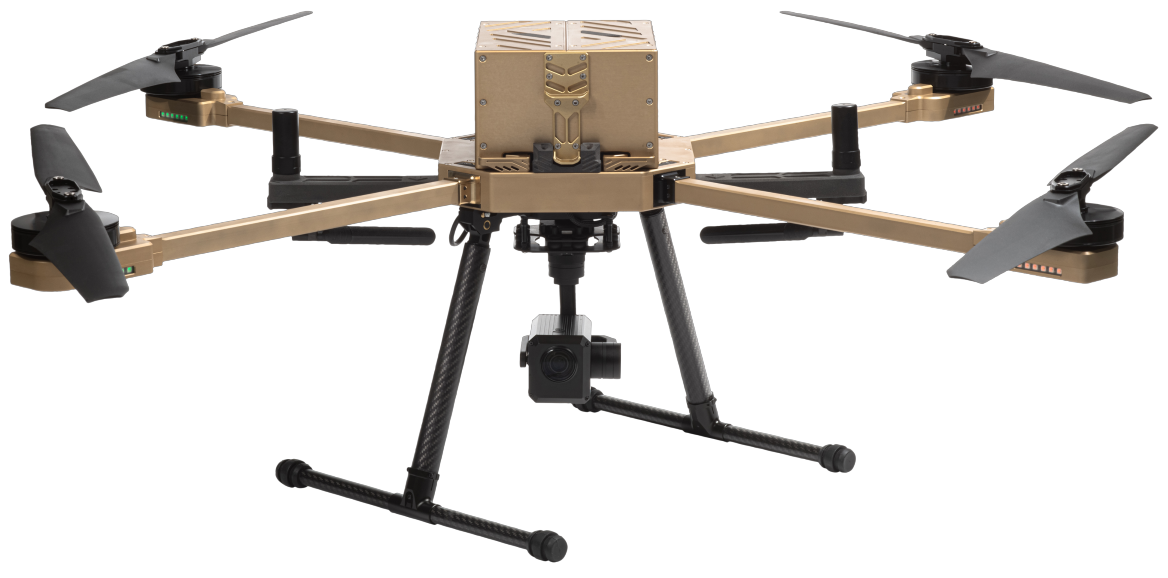
Atlas-T is engineered for covert operations and subtle reconnaissance. Its signature feature emphasizes low visibility and a discreet acoustic signature, making this drone perfect for anti-poaching missions, as well as animal monitoring without disrupting and alarming the animal.
Nextech platforms
Nextech Solution
At Nextech we recommend the Nextech Solution, which features thermal and 10x optical zoom sensors for wildlife and game monitoring applications.
Nextech specialises in the design, manufacture, and marketing of long-range, industrial strength, commercial use sUAVs. The Atlas-V and Atlas-T are both engineered for long-range and high endurance missions. Both UAVs are unparalled in their performance with multiple payload capability, extended flight times, rapid deployment & AI powered fully autonomous flights.
Long-range drone products have the potential to bring huge benefits for a variety of industries, including conservation, surveillance and security, inspection & detection, wildlife conservation and construction. Individual solutions can be developed to meet your specific requirements; and services include support and training during implementation, as well as post-implementation.
From South Africa to the UAE
At Nextech we service an international base of clients, ranging from South Africa to the UAE.
Our clients come from a variety of different industries, including: Oil and Gas, Marketing, Real Estate, Electrical installations, Security, Game farms, Wildlife management, Agriculture, Telecommunications, Travel and tourism, Satellite electronics, Wind farms, Sheet metal manufacturing, Industrial Rope Access, Environmental Affairs, and Other Applications.